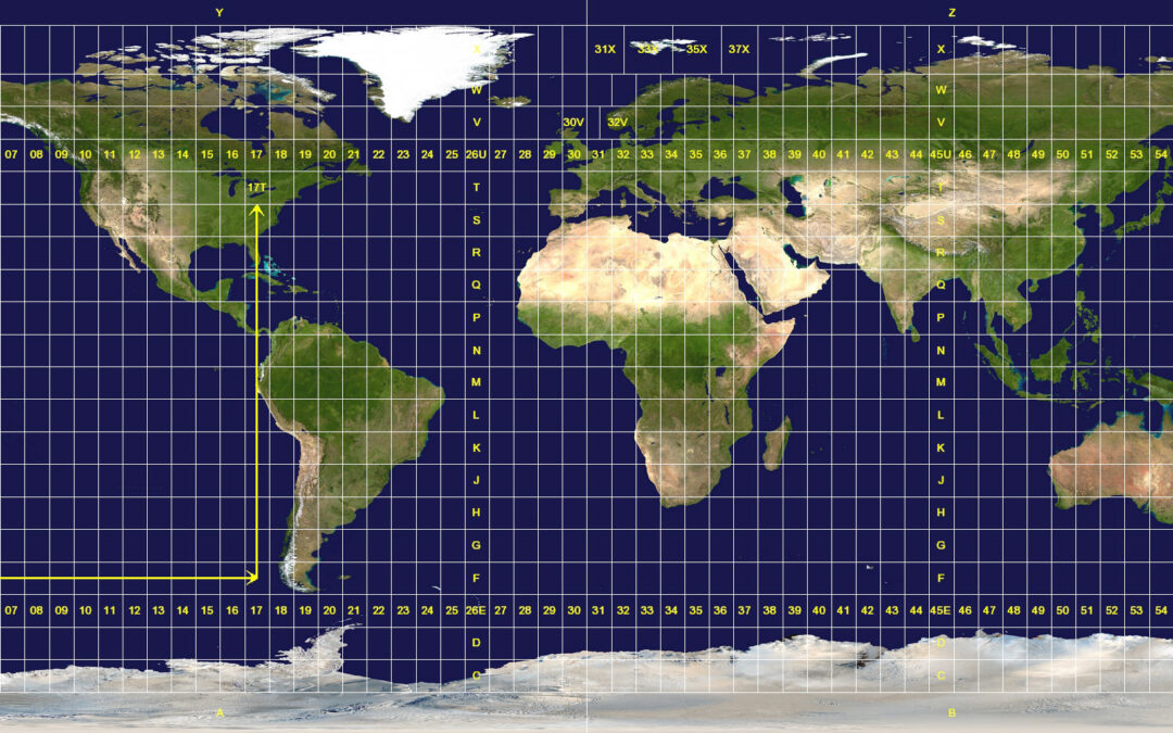
From geographic coordinates (latitute and longitude) to projected coordinates (UTM) with Arduino
The quastion is: how can we pass from geographic coordinates (latitute and longitude) to projected coordinates (UTM) with Arduino? GPS recievers usually output (or can be setup to output) their data in plain text NMEA 0183 sentences and the coordinates are expressed...